The lesson: check topo before you spend on due diligence
Look at the topography before you pay for anything. It takes a few minutes and it is free or close to it.
I found this out in due diligence, after the site was under contract.
Pulling contours before you sign raises the question while it still costs nothing to walk away.
Why Street View is not enough
Street View shows you what a camera on a car can see. It does not show you elevation, and it does not show you what is behind the first row of grass.
It is good for some things. You can see the curb cuts, the signs, the neighbors and the condition of the road.
It is bad at ground shape. A camera a few feet above the pavement flattens everything, and a low spot in a field looks like a field.
Existing curb cuts tell you about access. They tell you nothing about the ground.
What to look for on a topo map
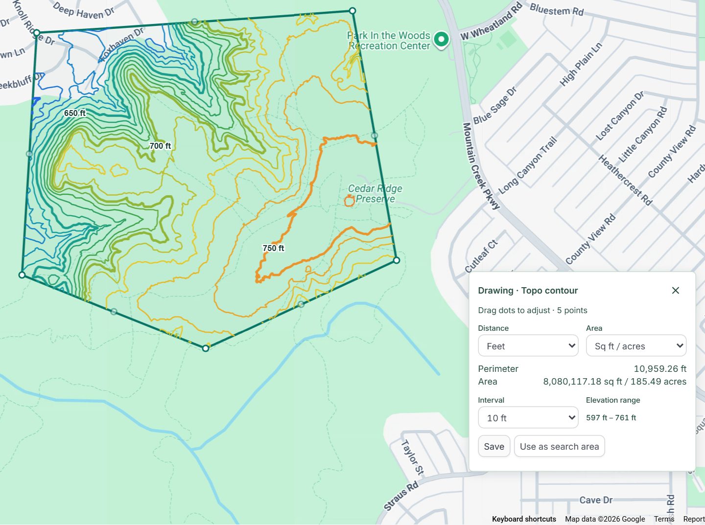
You are looking for anything the road does not show you. Contour lines connect points of the same elevation, so their pattern tells you the shape of the ground.
- Closed loops where the elevation drops toward the middle. That is a depression, and in limestone country it may be a sinkhole.
- Lines packed close together. That is a steep slope, and it means grading cost.
- The overall fall from one side of the site to the other, and which way water will run.
- A flat area big enough for the building, the parking and the drive-through lane.
One caution. Contours from public elevation data are for early review. They are not a survey, and they will not tell you what a state agency has classified.
How to check topography in MapRE
You outline the site and MapRE draws the contours. Here are the steps.
- Find the site on the map.
- Open the drawing tools and choose Topo contour.
- Draw a boundary around the area you want to study. One area can be up to 500 acres.
- Pick a contour interval: 1, 2, 5 or 10 feet.
- Read the labeled lines and the low and high elevation for the area.
The elevation comes from USGS 3DEP data. Where that data is too coarse for 1 foot lines to be reliable, MapRE tells you.
What else to check while you are there
Topo is one of several things worth a look before you tour a site or sign a contract. On the same map you can turn on:
- FEMA flood zones.
- Wetlands from the National Wetlands Inventory.
- Zoning.
- Traffic counts.
None of these replace an engineer, a survey or a call to the state. They tell you which questions to ask first, and which sites are not worth the drive.
Who to ask when the map shows a low spot
Ask the people who would have to approve the site. A map can show you a depression, but only an agency can tell you how it is classified.
- Your civil engineer, who can tell you whether it looks like a sinkhole.
- The state environmental agency, which decides how a feature like this is classified.
- The city or county, which may have its own setbacks.
When you see a depression, ask before you sign
If the contours show a closed depression, treat it as a question for the state and for your engineer. Ask it during your first look, not after the contract is signed.
On this deal the topo did its job. Now I look at it first.