
Check zoning before you go under contract
Turn on the zoning layer to see the district on every parcel. Then open a zoning report for permitted uses, setbacks and height.
The zoning report for a point.
This is a real report for a point in Dallas. It lists the district, the site limits and the uses, as the source reports them.
Read the split zoning story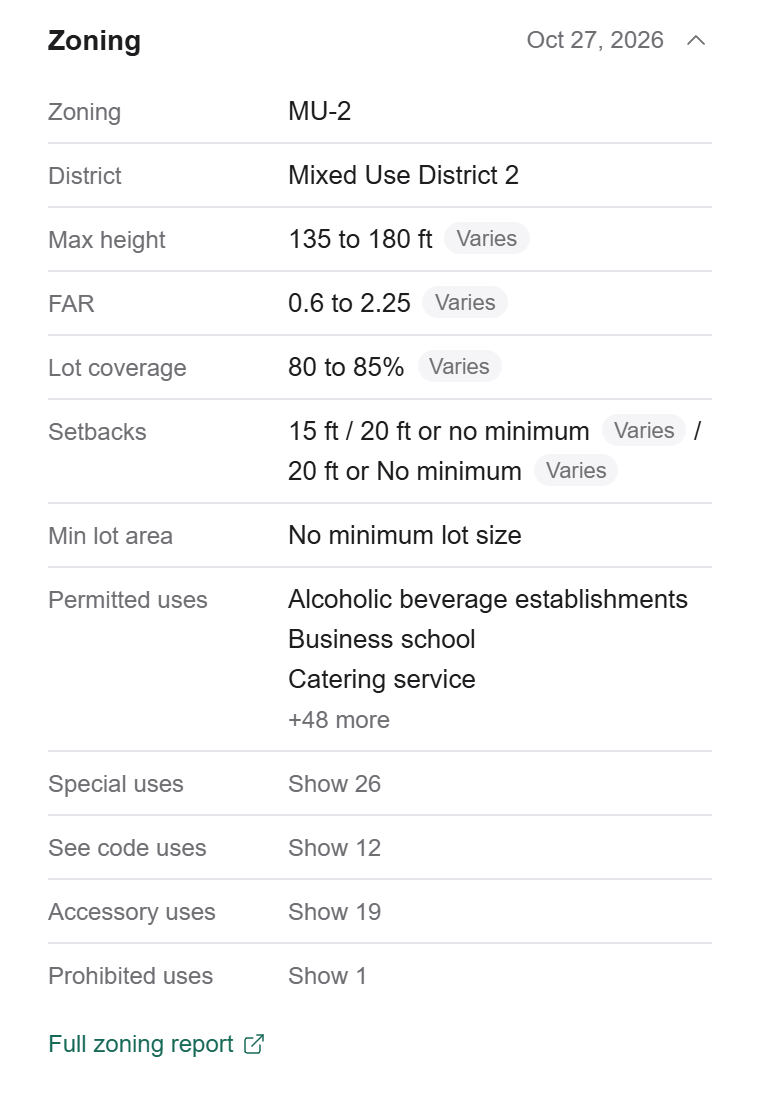
See where the district lines fall.
Districts are colored by type and labeled with the zoning code. A boundary that crosses a parcel means split zoning.
Check topo tooIllustrative demo · Sample data
What the zoning report shows.
Zone and uses
The zone code and district, with permitted, conditional and prohibited uses.
Site limits
Max height, FAR, lot coverage, setbacks and minimum lot area, where the source has them.
Every parcel
A report covers the point you click. On an assemblage, check each parcel.
Common questions
Does MapRE cover every city?
No. Coverage varies by jurisdiction, so confirm current zoning with the municipality.
Why can I not see zoning?
Zoom in. Zoning shows at zoom level 15 or closer.
Try MapRE free for a month.
Every plan starts with one free month. No card needed.
Start free trialQuestions? Contact us